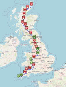
LEJOG (Off road)
Below is the GPX for Lands end to John o’groats not been tested by me (yet) over 24 days In the window below: bottom left click on the icon to
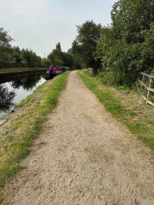
Dobcross loop gravel
This is a short 12 mile loop using canals, bridle paths and quiet roads sorry no coffee stop images along some of the route:
Marsden Holmfirth loop 2
This is a loop form Marsden to Holmfirth using the quiet roads, stopping at the Cave by Bear coffee house in Holmfirth. the route uses mainly Route 68 and WYCR
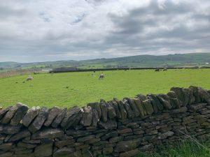
Wooldale to Hepworth loop
This is a gentle walk starting and ending in Wooldale, calling off at the Butchers Arms for Lunch and then walking back a shorter second half. generally off road
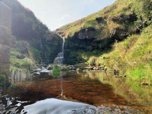
Hike around Marsden moor
This hike is a loop around 7.5 miles long starting and ending in Marsden.
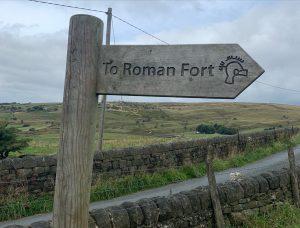
Marsden to Roman fort
Distance: 14 miles. Climbing: 1576ft The walk starts and ends at Marsden and follows the standedge trail and then the Pennine bridleway. Take Old mount road up to the start
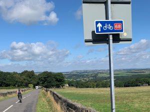
Marsden Holmfirth loop 1
This is a loop form Marsden to Holmfirth using the quiet roads, stopping at the Bloc coffee house in Holmfirth. the route uses mainly Route 68 and WYCR Map of
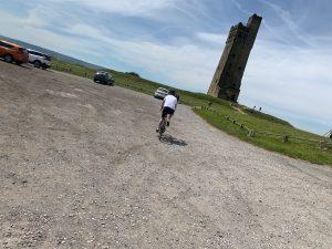
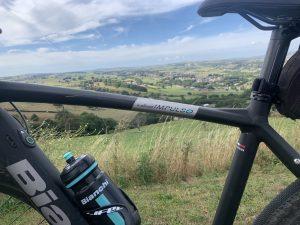
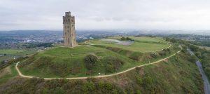
Marsden to Castle hill loop
This is a 20 miles road/ gravel route from Marsden (parking at the station) to Castle hill and stopping at Hinchliff’s farm shop at around 12 miles for lunch. Map
Marsden to Emley moor via castle hill loop
This route uses the quieter, smaller roads from Marsden past Blackmoorfoot res to Castle hill and then onto Emley moor and then stopping at Dobbies Garden Centre Pennine at around
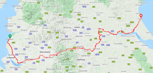
Trans pennine Trail
The Trans Pennine Trail another coast to coast route but it is mostly off-road. The Trail is largely purpose-built using canals, riversides, disused railway lines, minor roads and urban cycle
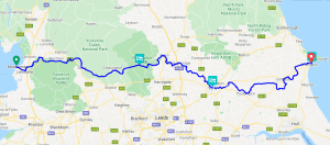
Way of the Roses
This is a coast to coast route which is 170 miles, starts in west coast at Morecambe bay in Lancaster (the red rose) through Yorkshire (white rose) to Bridlington in
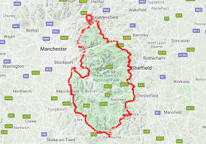
Tour du Peak District National Park – Clockwise
This multi day route starts and stops in Marsden, West Yorkshire and skirts all around the edge of the Peak District National Park Interactive map
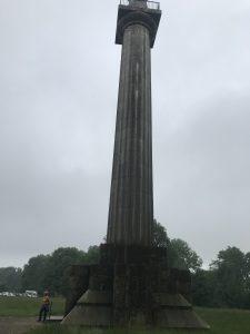
Chesham Bois to Waters Edge Cafe in Marsworth
This is a circular route starting and ending at the Memorial at Chesham Bois Village. It is a 37 mile loop with a coffee stop at 20 miles. Map and